


A 9.9 Acres Lot in Pasadena, CA!
Payment Options
Description
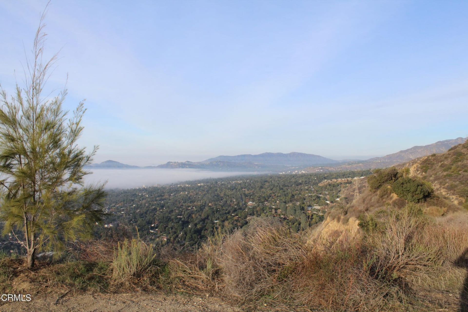
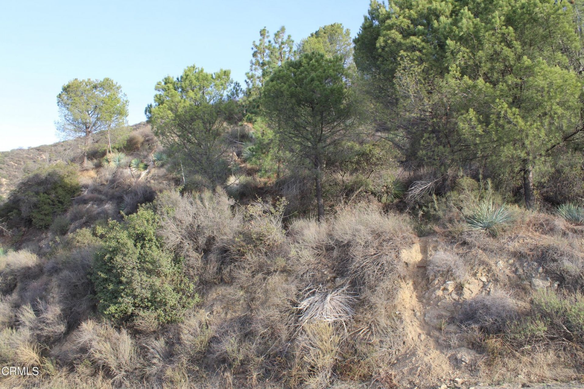
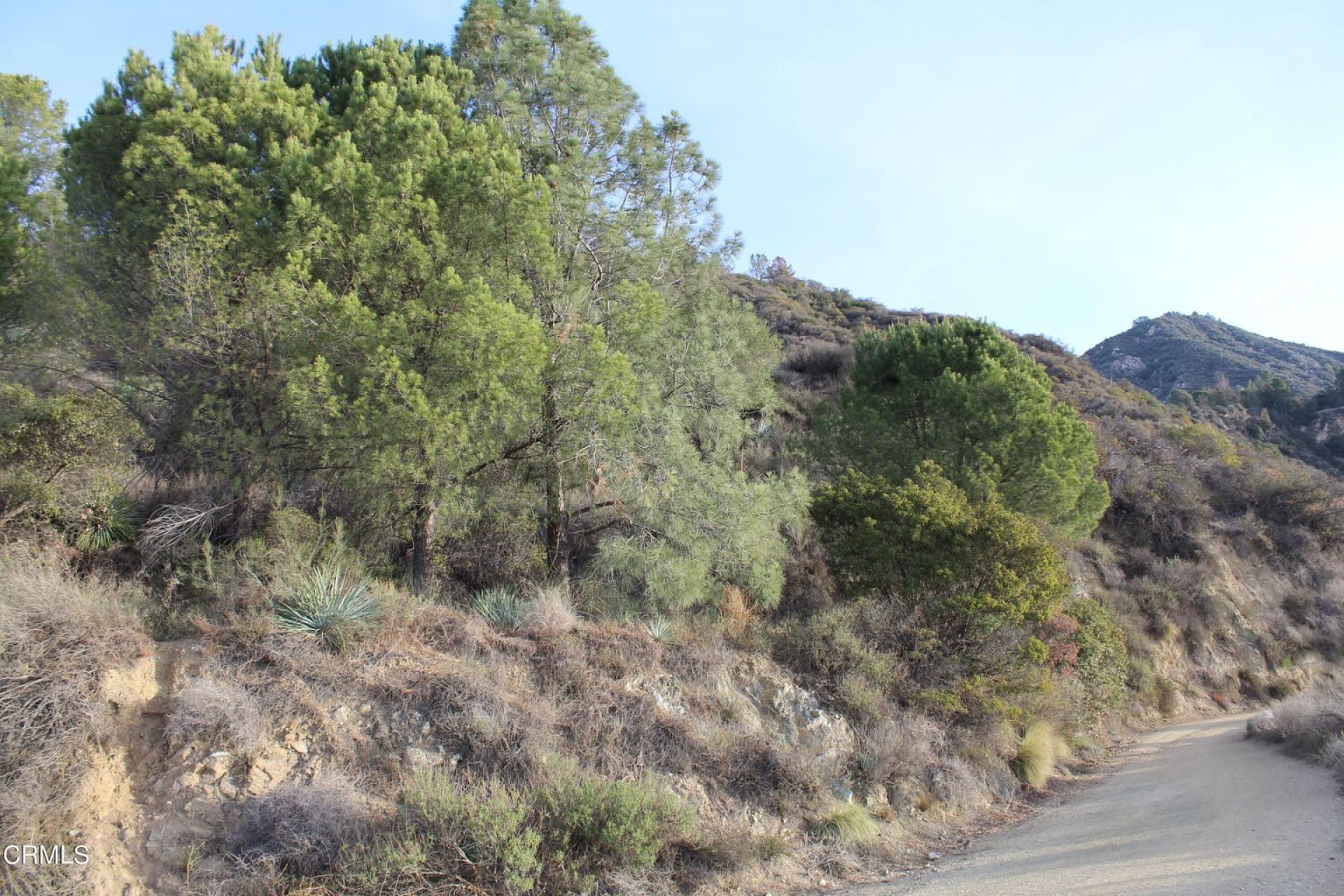
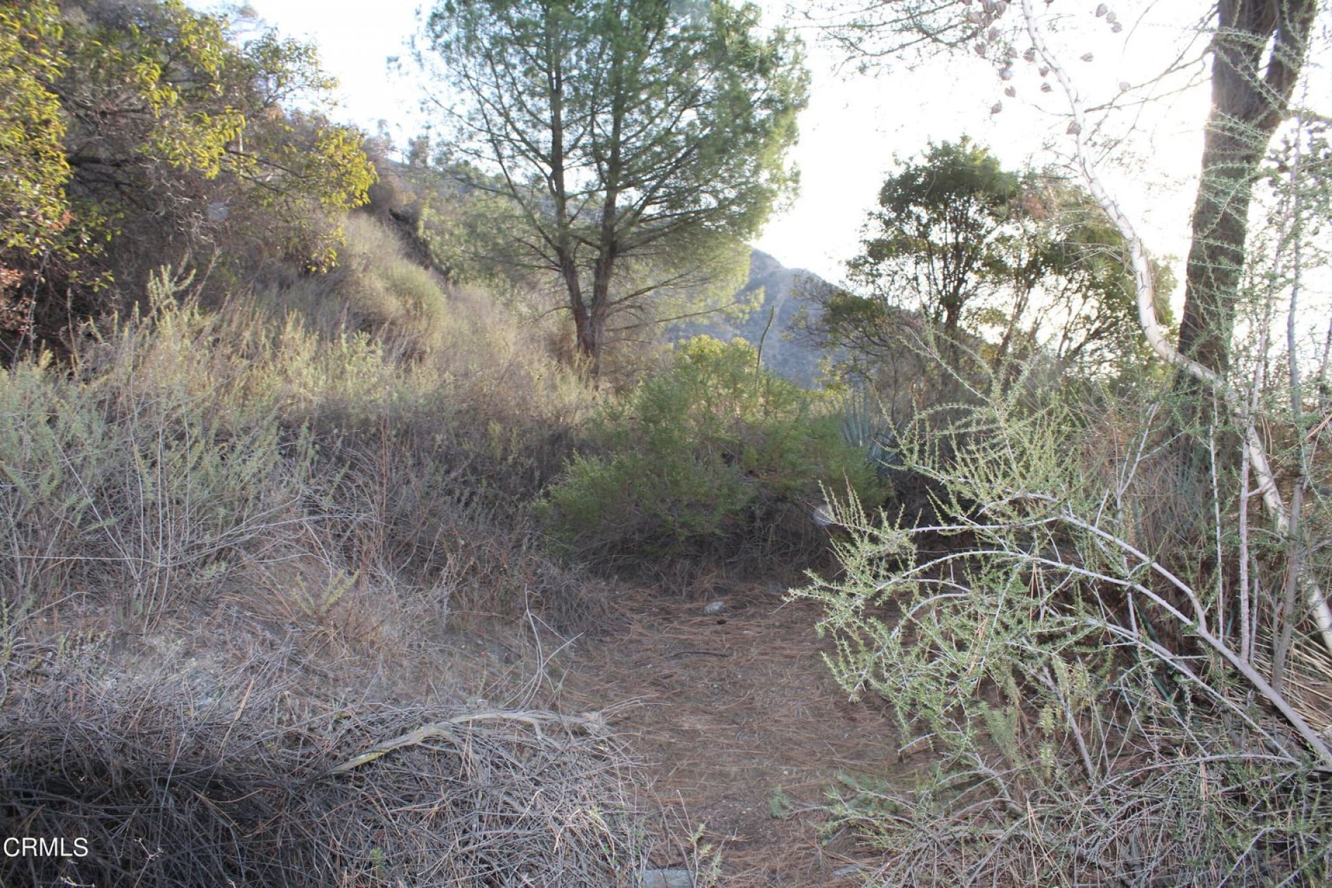
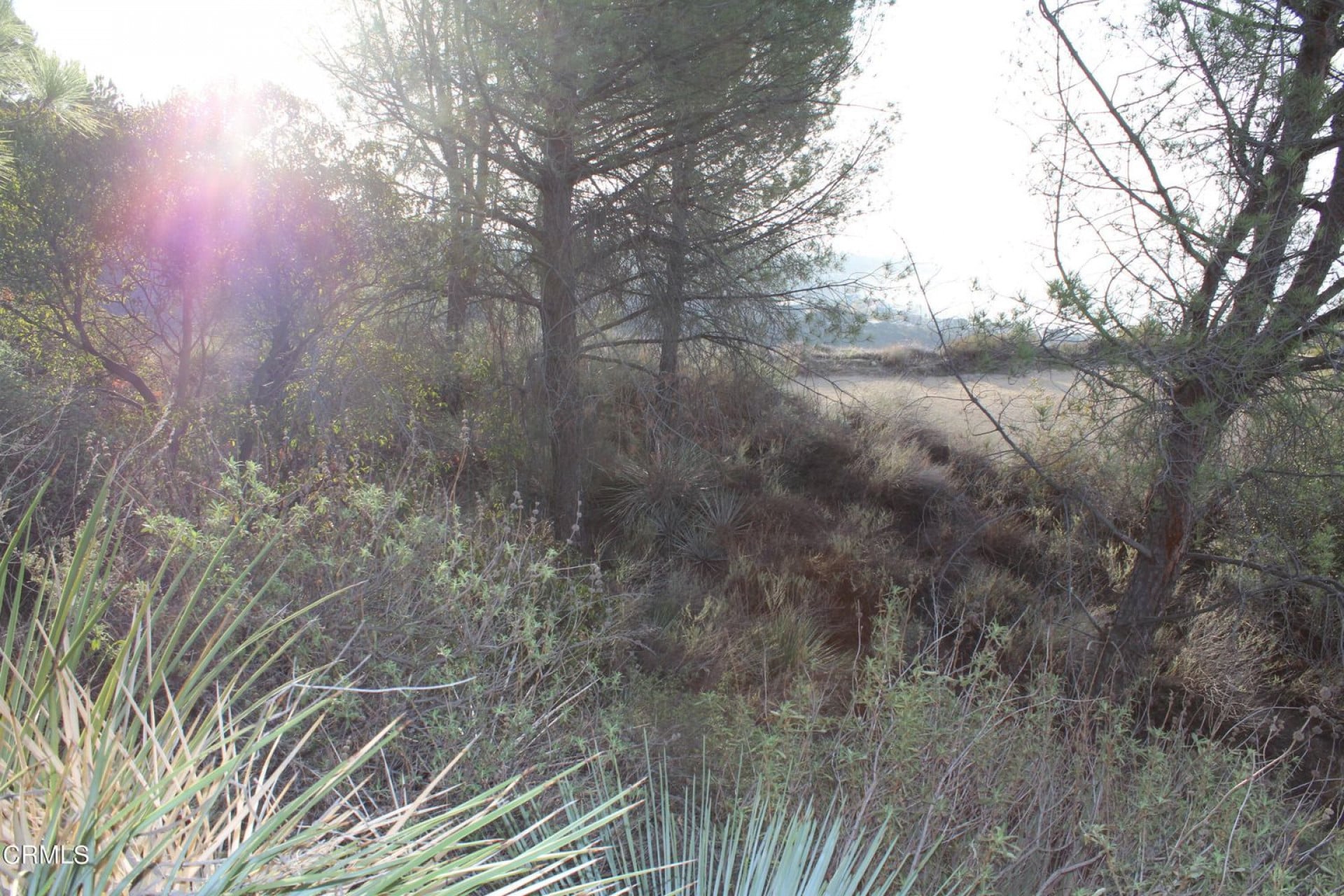
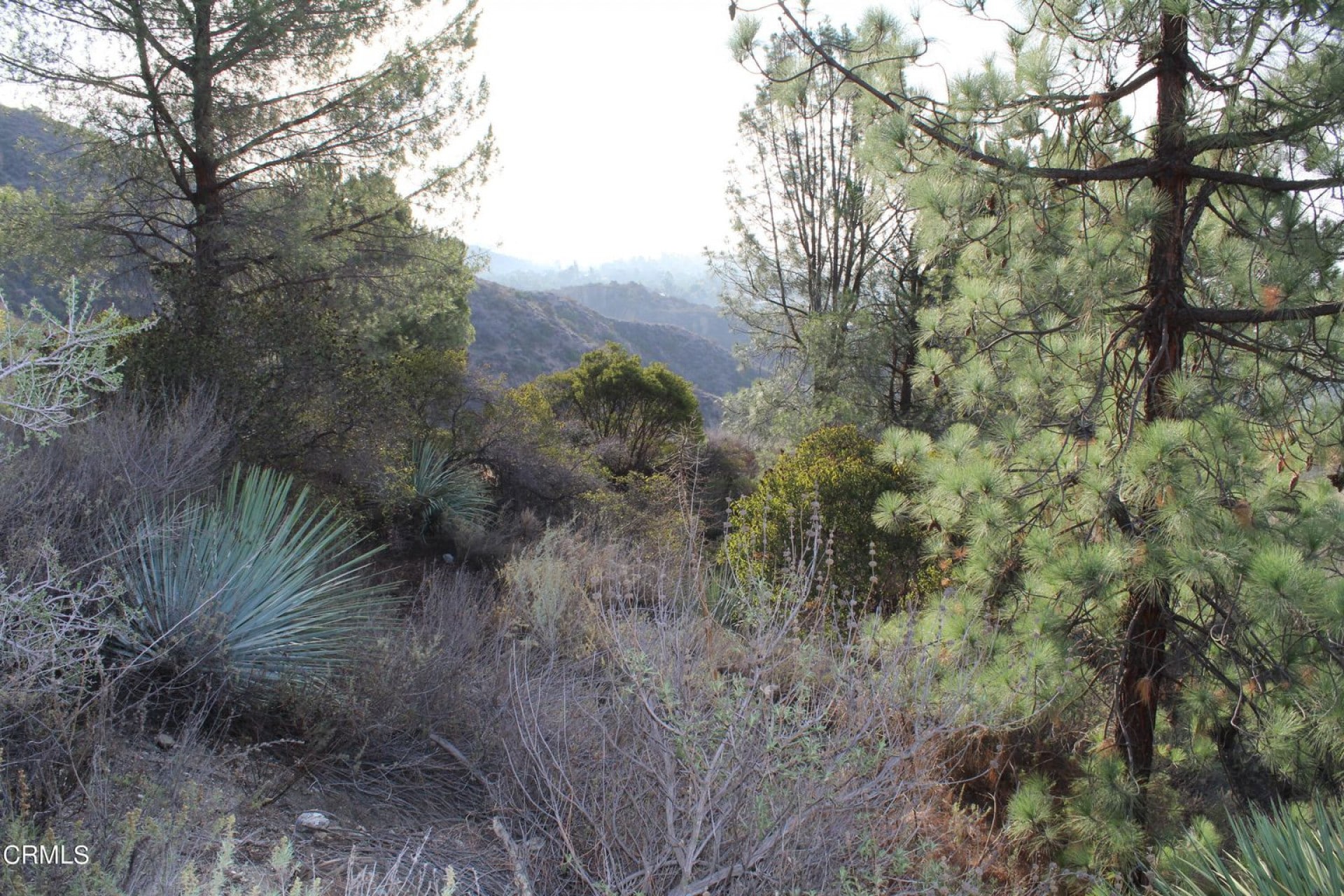
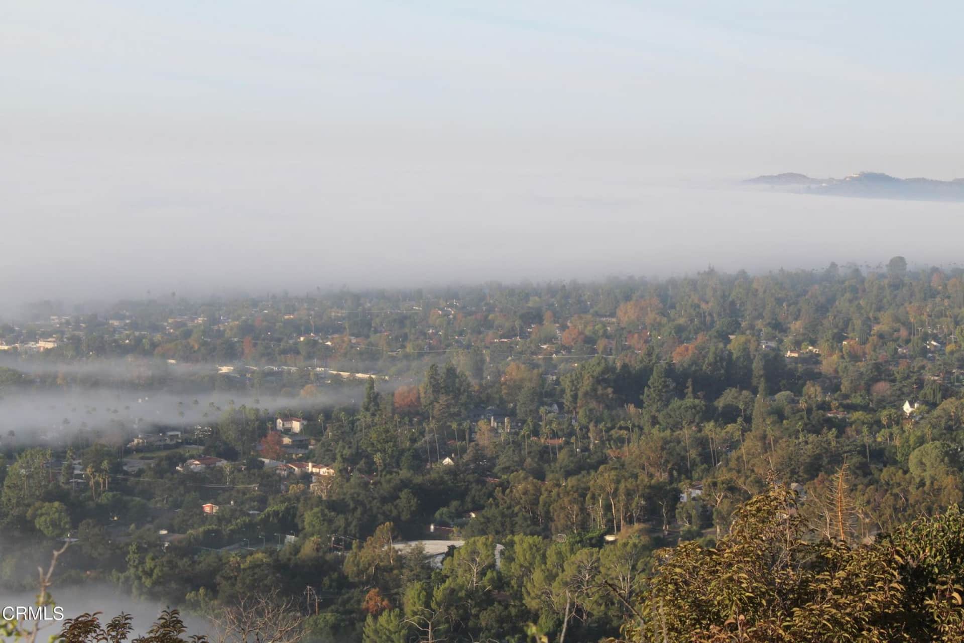
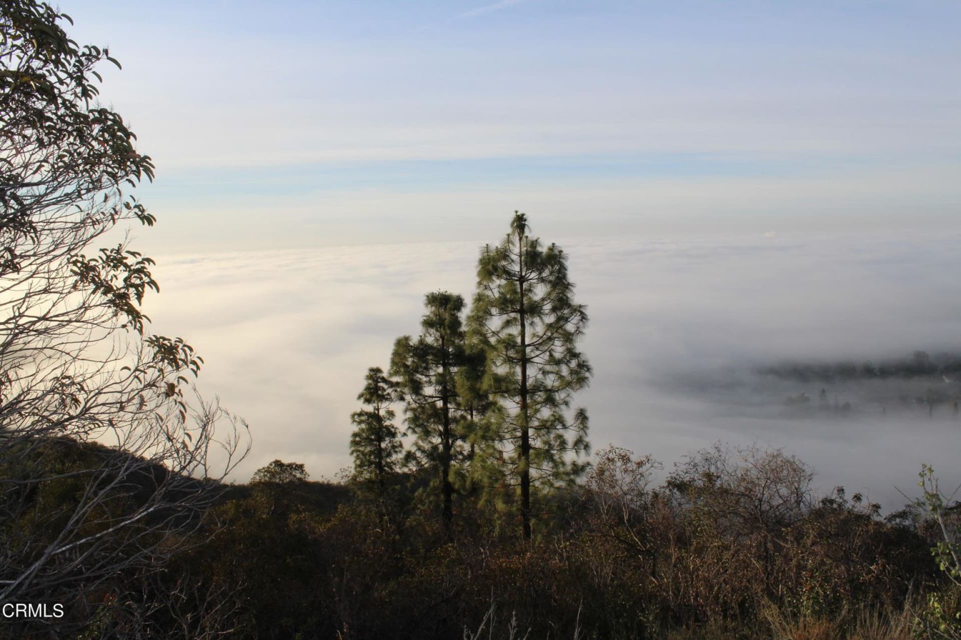
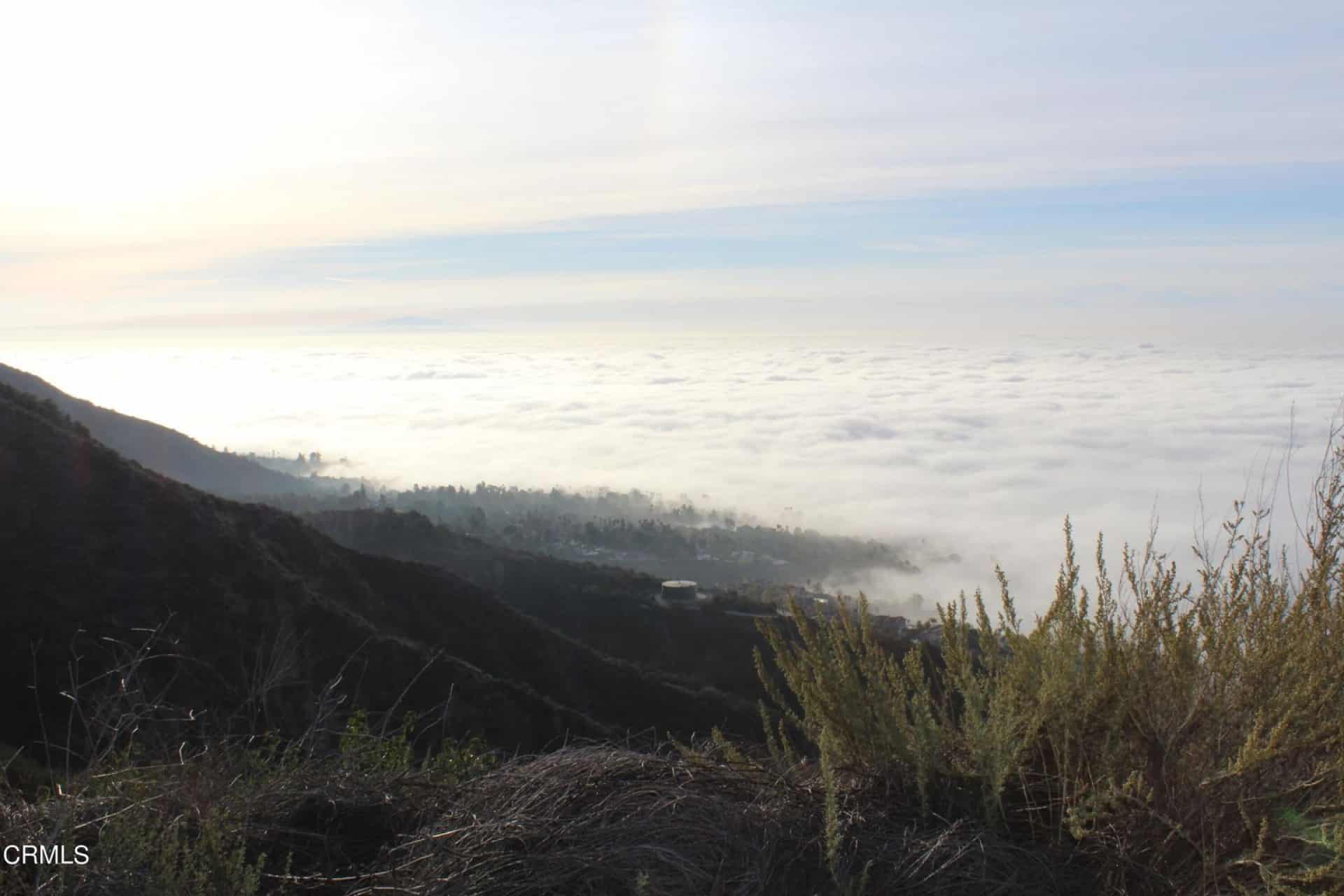
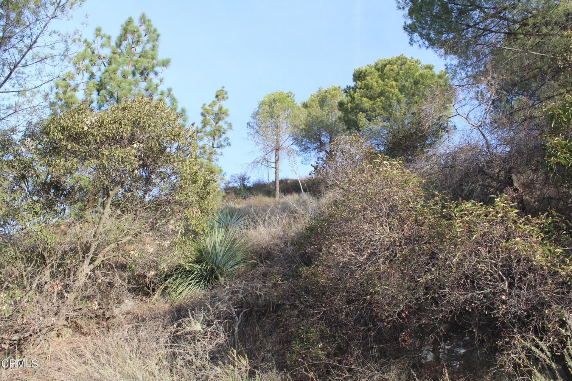
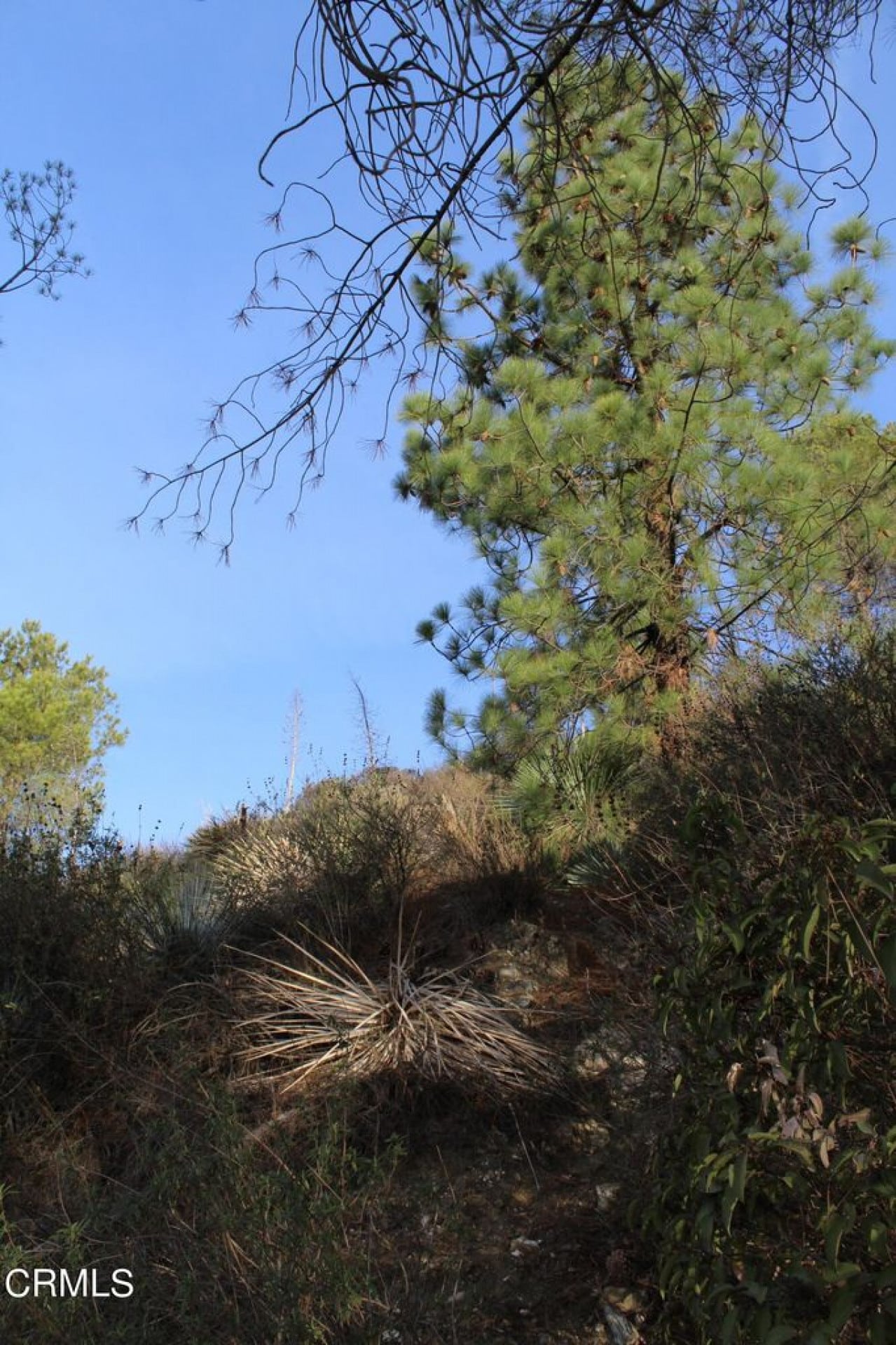
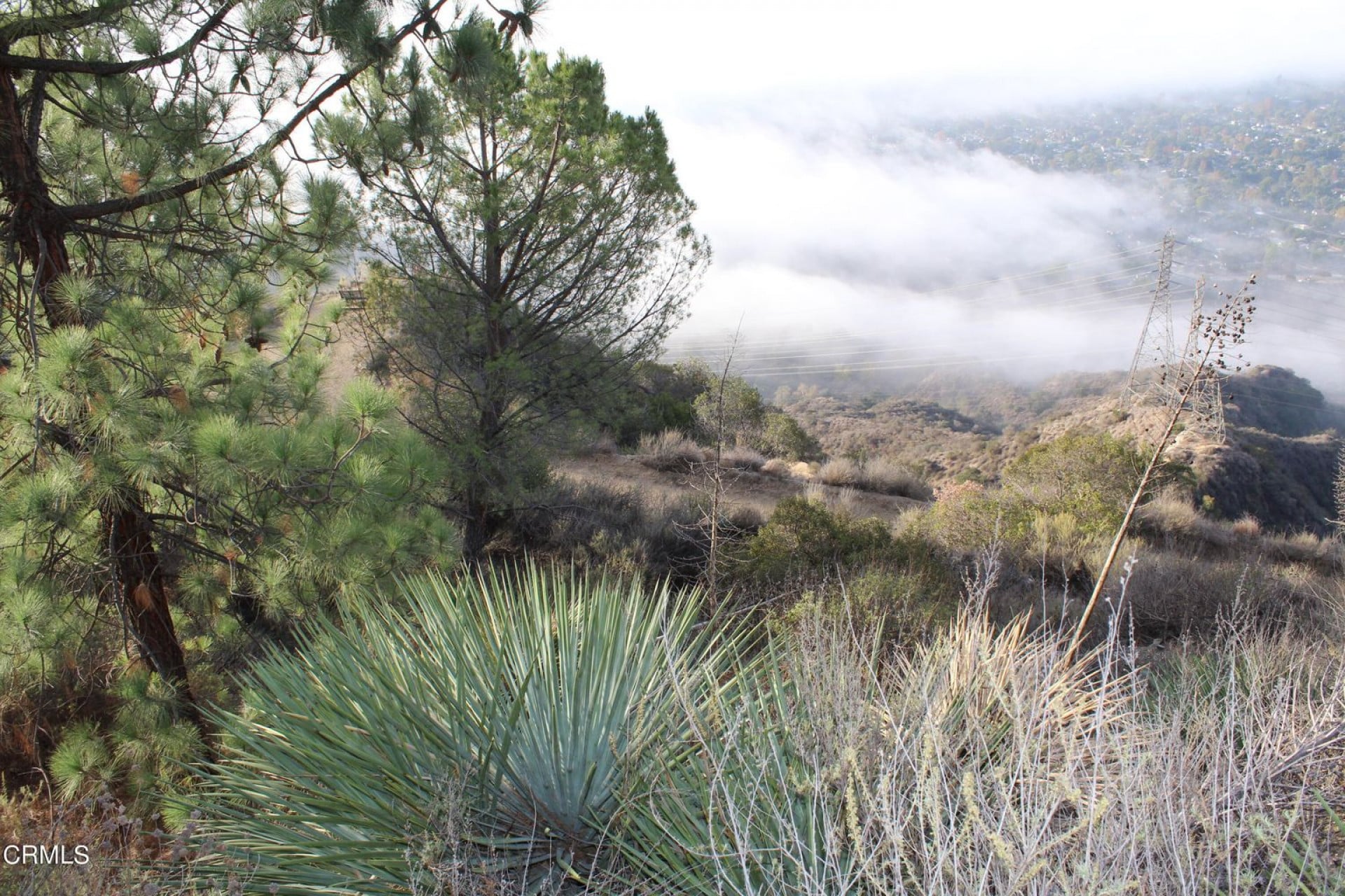
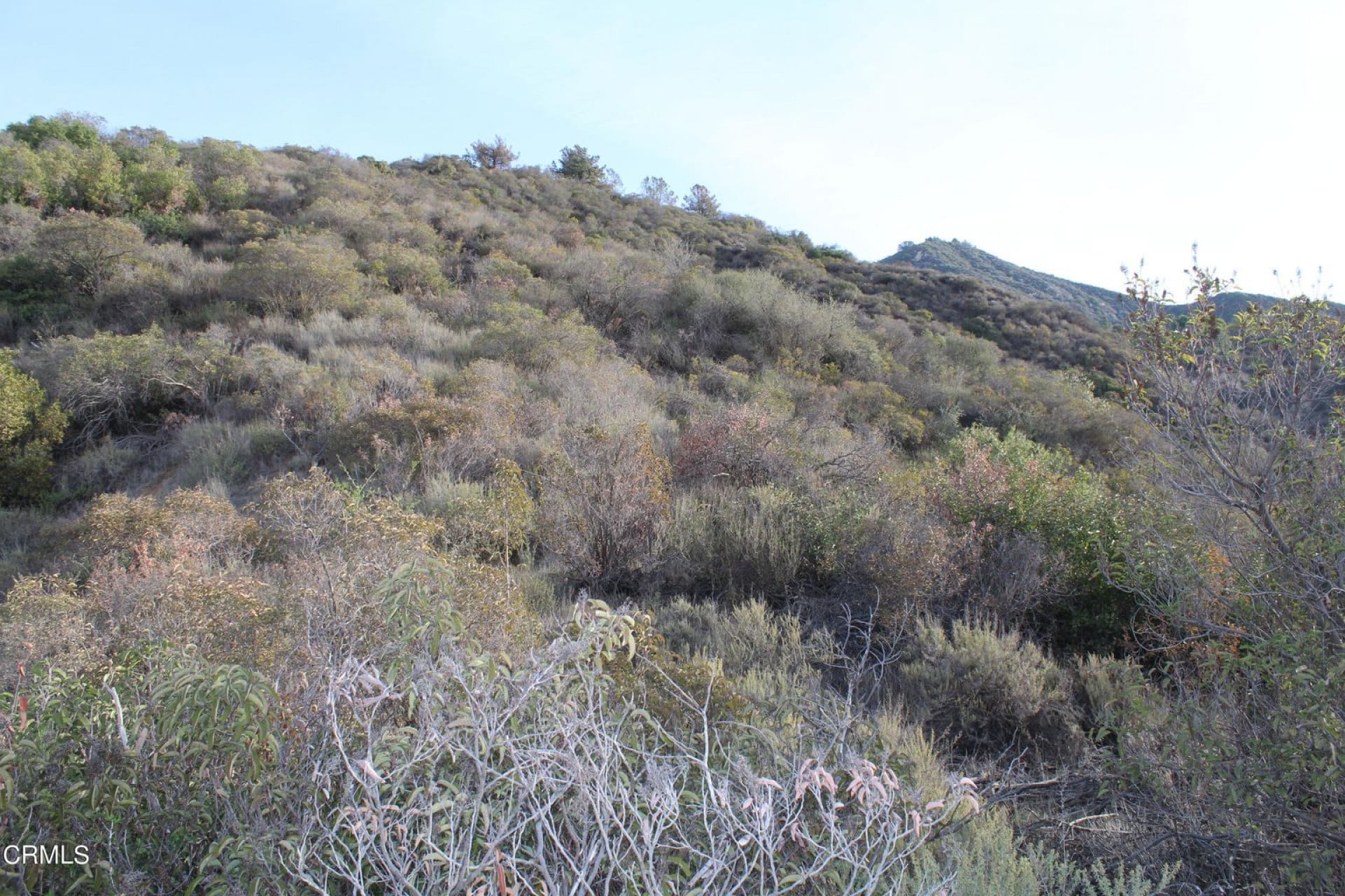
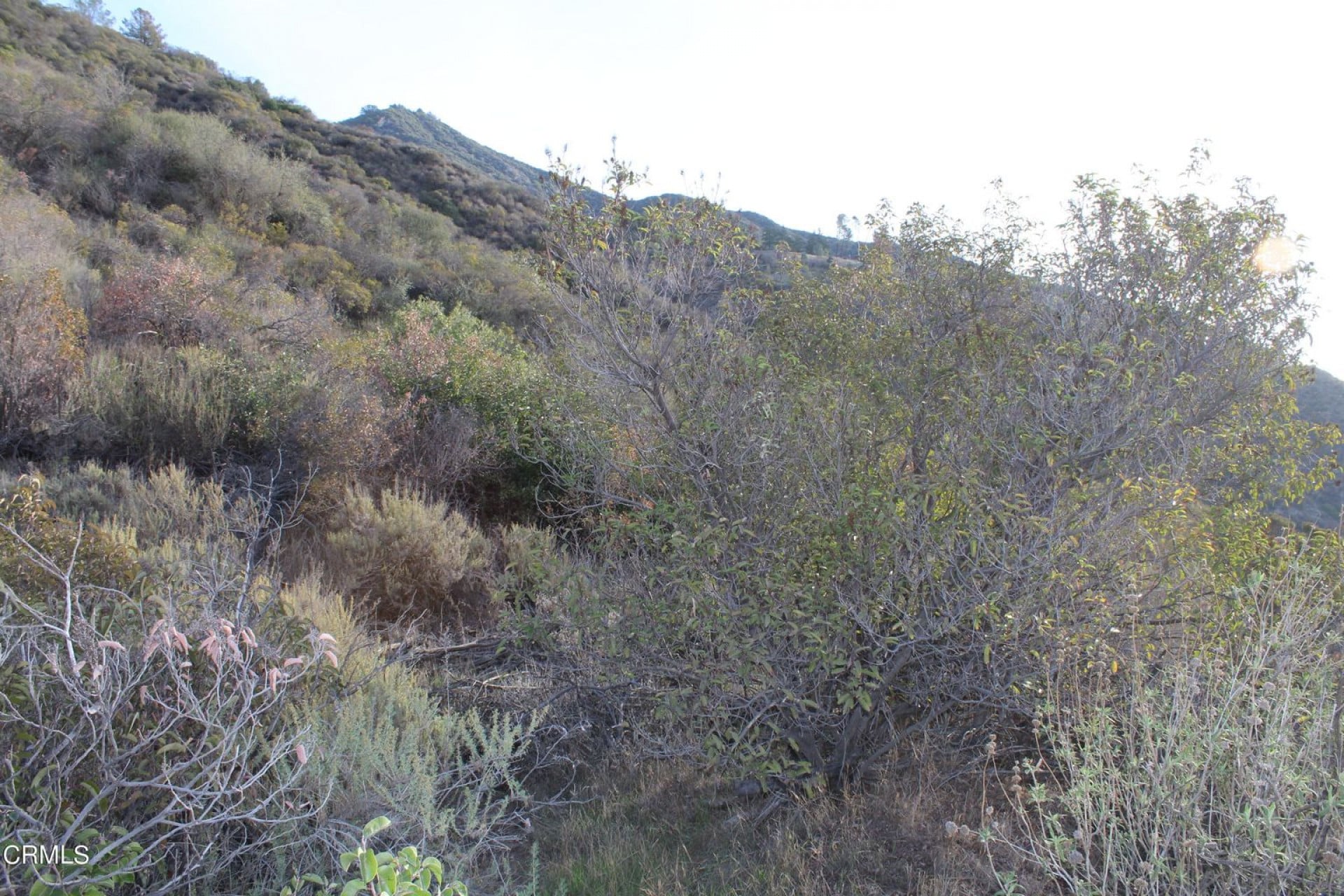
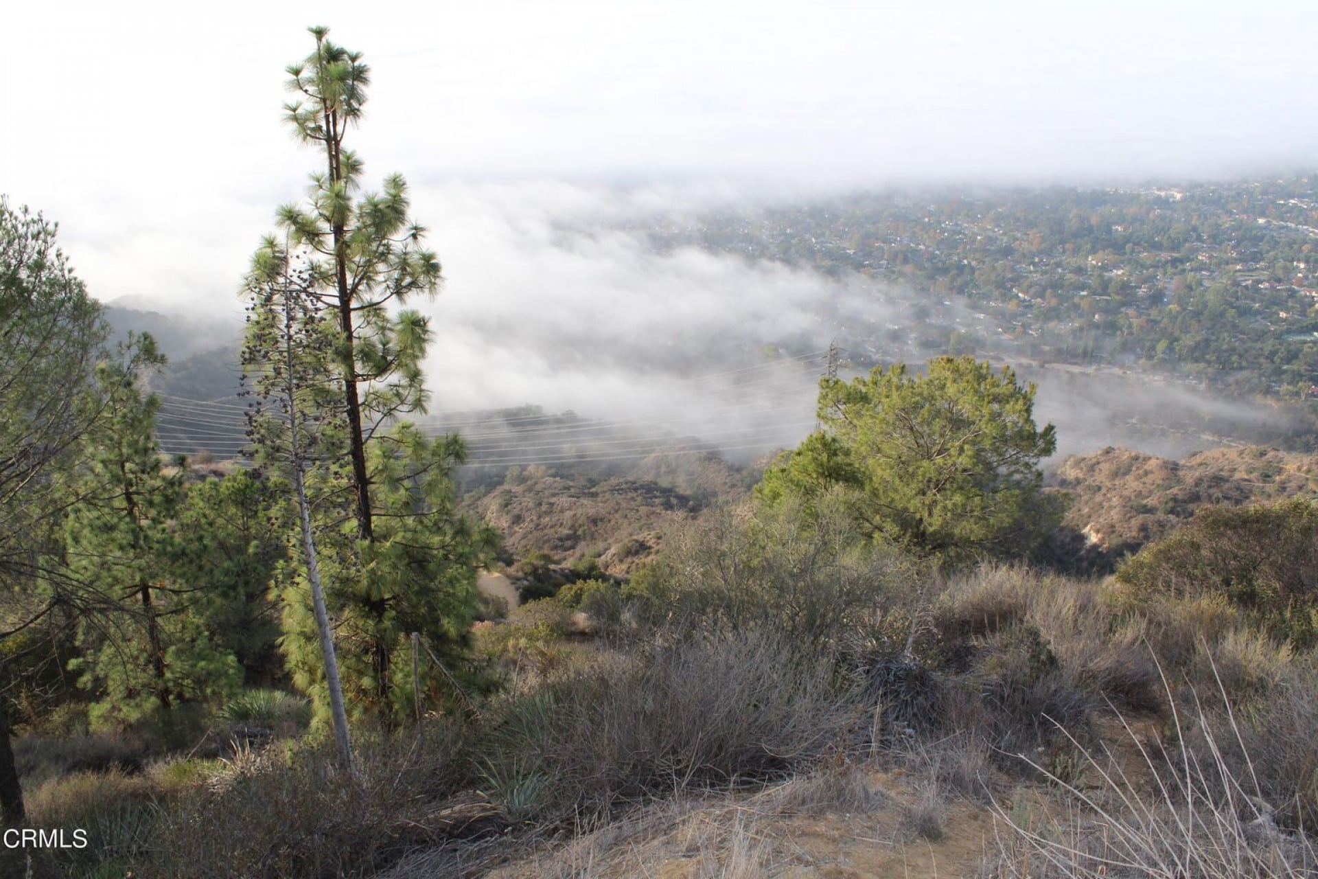
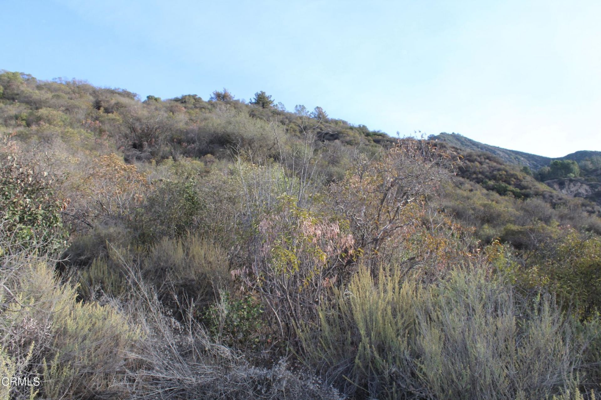
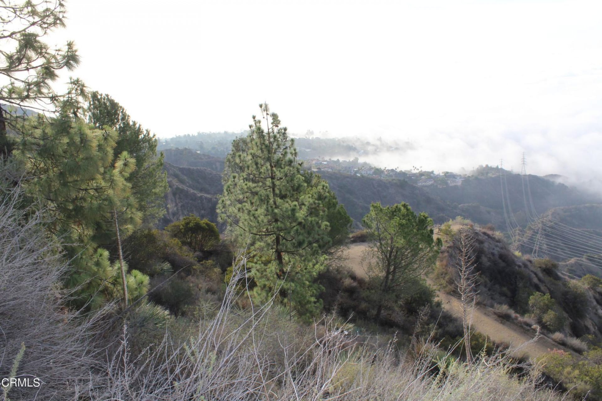
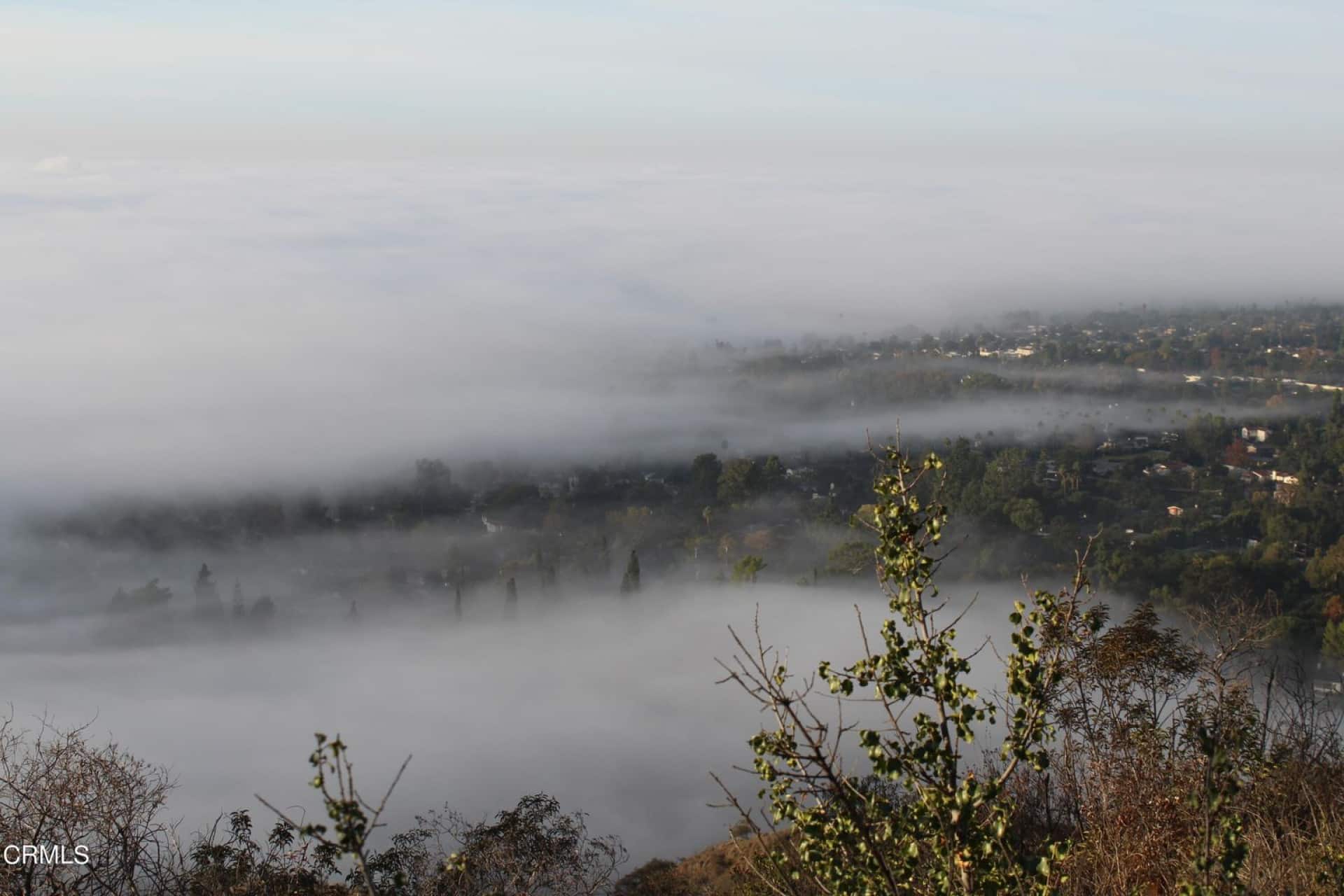
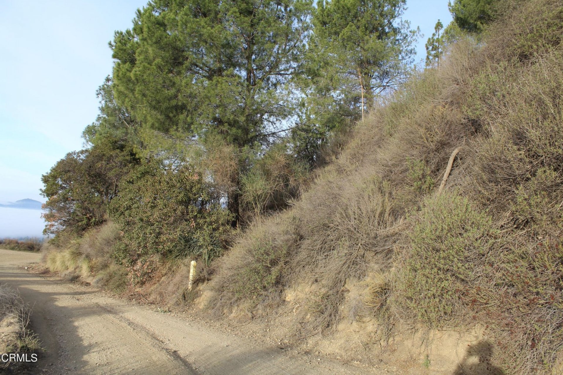
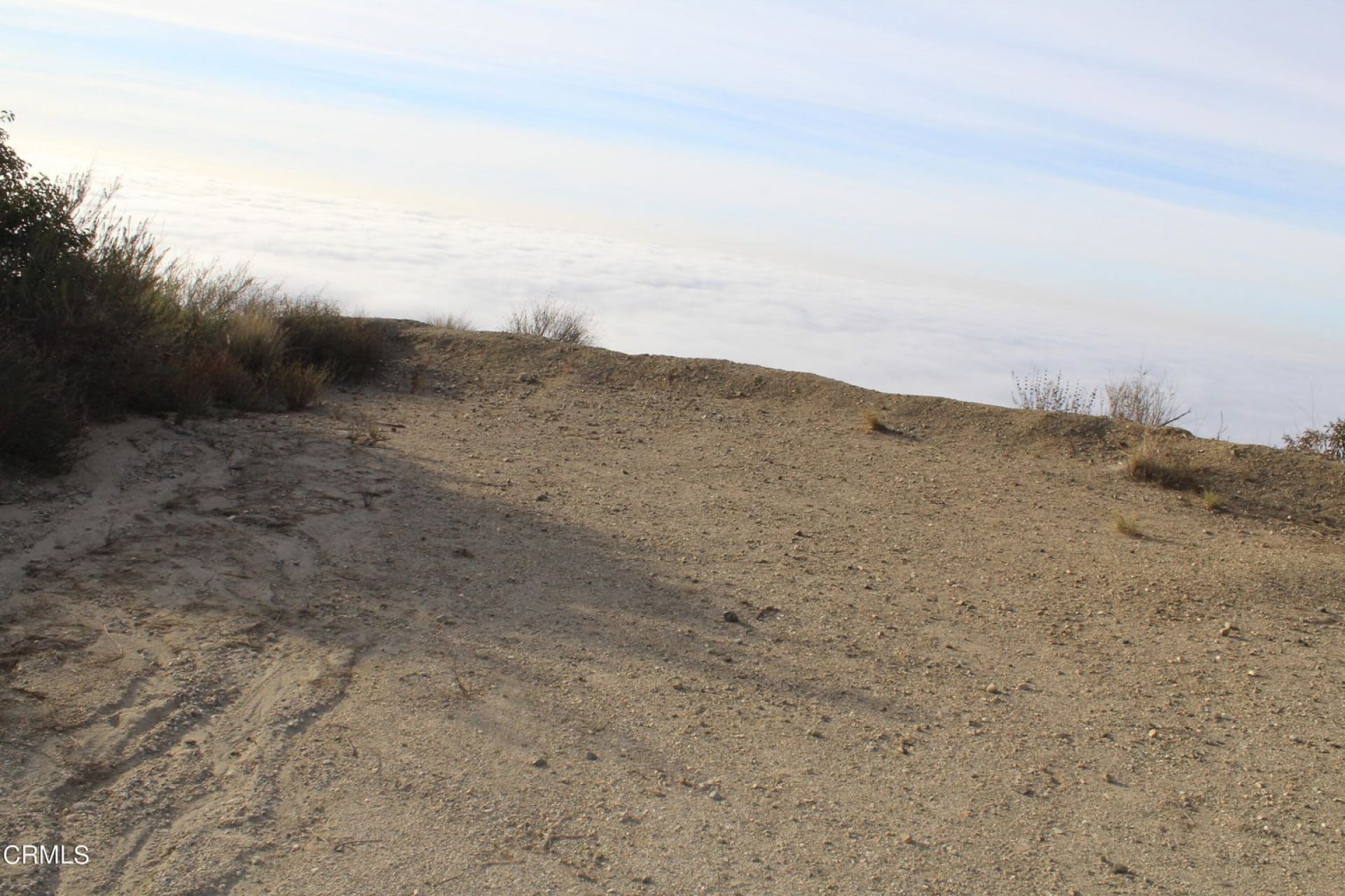
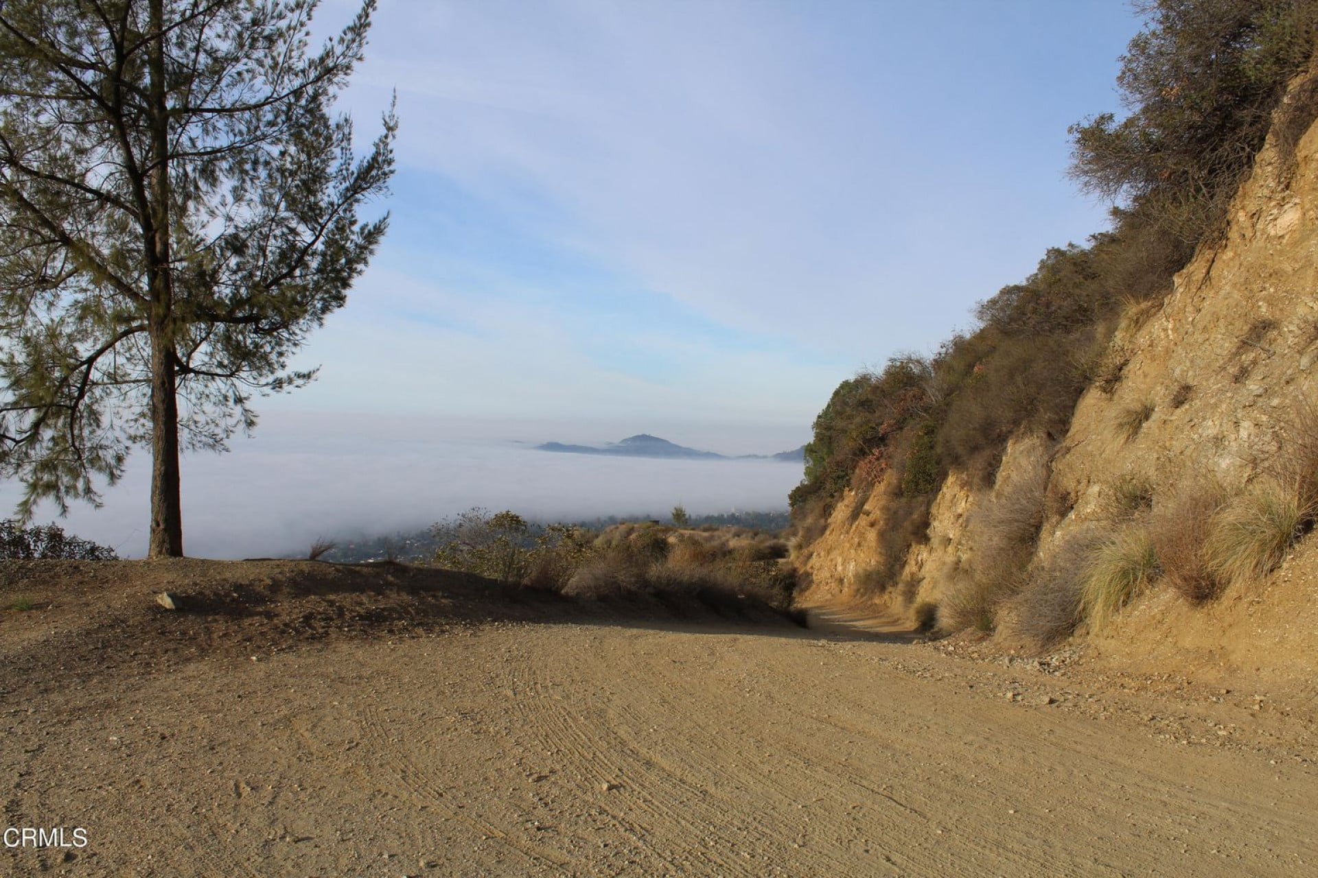
A total of 9.9 acres of land off of Mt Wilson Toll Road, with views over the valley. Mt Wilson Toll road is a popular hiking destination, with views over the city. It allows access to many other hiking trails in the area. Own your very own piece of the forest. Main uses include recreation, hiking, camping and bird watching.
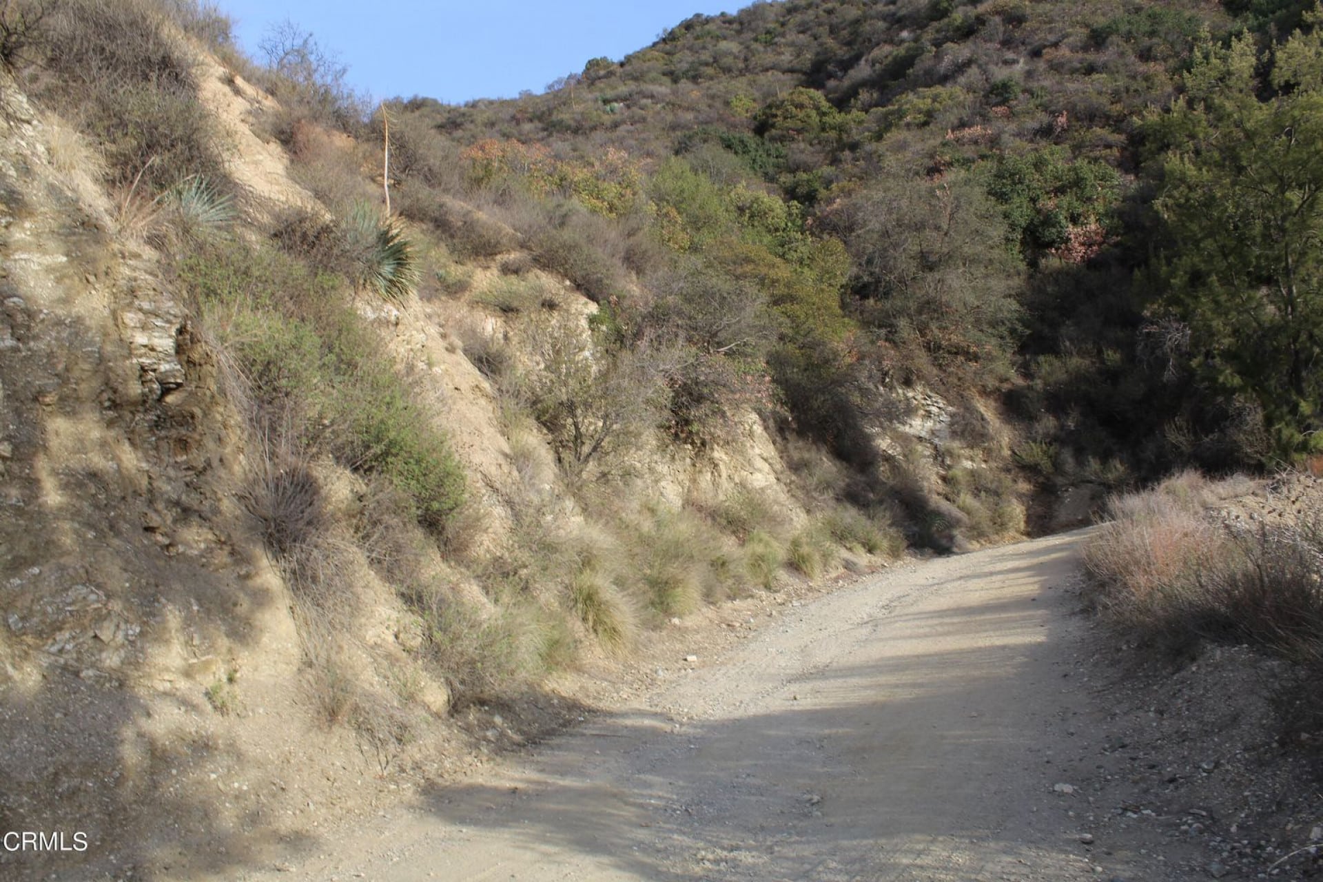
Enjoy beautiful views, the smell of sage and pine trees, nature at its finest. The parcel is hilly with a few small terraces and a small animal trail to the summit. Please talk with listing agent before entering the property. Exit North on Altadena Drive, proceed .08 miles to Henninger Trailhead. The hike is approximately 2 miles on Mt Wilson Toll Rd to property. This trail is also used for mountain biking and horseback.
Property Information
County: Los Angeles
State: California
Size: 9.9 acres
APN: 5857-002-002
Legal Description: 10 ACS SE 1/4 OF NE 1/4 OF NW 1/4 OF LOT 12
Zoning: LCRA2*
Roads: Dirt Road
General Elevation: 1750 ft.
Terrain: Sloped
Property Tax: $217.15
Approximate Distance to Nearby Cities & Points of Interest
7 min (2.8 miles) to Mt Wilson/Pinecrest Gate
49 min (30.2 miles) to Mount Wilson Observatory
48 min (29.9 miles) to Mt. Wilson Skyline Park Picnic Site
47 min (29.7 miles) to First Water, Mt. Wilson Trail
13 min (5.2 miles) to The Huntington Library, Art Museum, and Botanical Gardens
GPS Coordinates (approximate):
34.1906705812651,-118.092032829225 ;34.1916564122832,-118.092063081407 ;34.1915973167322,-118.094154796252 ;34.1902762489726,-118.094120504222 ;34.190096927606,-118.094114383103 ;34.1897264389303,-118.094105500455 ;34.1897699332244,-118.092003961204 ;34.1904926337524,-118.092026681006 ;34.1906705812651,-118.092032829225
Property Information
Parcel Size
9.9
State
California
County
Los Angeles
Parcel Number
5857-002-002
Address
0 Mt Wilson Toll Road
Legal Description
10 ACS SE 1/4 OF NE 1/4 OF NW 1/4 OF LOT 12
Features
Acres
9.9
County
Los Angeles
Access
Dirt
Power
Near in the area
Coordinates
34.1906705812651,-118.092032829225
Zoning
Residential
Elevation
2,124
Nearby Attractions/City
Altadena, California

Altadena (“Alta”, Spanish for “Upper”, and “dena” from Pasadena) is an unincorporated area and census-designated place in the Verdugo Mountains region of Los Angeles County, California, approximately 14 miles (23 km) from the downtown Los Angeles Civic Center, and directly north of the city of Pasadena, California.
The historic Mount Lowe Railway was a scenic railway that once carried passengers to any of four resort hotels high in the San Gabriel Mountains above Altadena and Pasadena. Although the mountains and the remains of the railway are not strictly in Altadena, the most direct trail to the sites, the Sam Merrill Trail, starts in Altadena at the top of Lake Avenue, and leads to Mount Echo, about 3 miles (4.8 km). Chaney Trail, just west of the intersection at Fair Oaks Avenue and Loma Alta Street, is a forestry service road leading to the old right of way. The Mount Lowe Railway site was placed on the National Register of Historic Places in 1993.
Altadena has a number of hiking trails, including the trail to the Dawn Mine, which can be reached via Chaney Trail to Sunset Ridge Trail. Arrows painted on large boulders direct hikers along the way.
PROPERTY MAP
